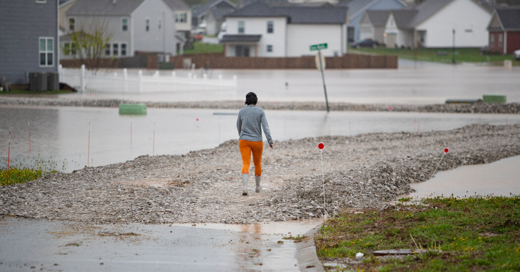
The severe storm system that has inundated the central and southeastern United States with heavy rain and high winds for days fits into a broader pattern in recent decades of increasing rainfall across the eastern half of the United States.
Data from the National Oceanic and Atmospheric Administration for 1991 through 2020 show that the Eastern part of the country received more rain, on average, over those years than it did during the 20th century. At the same time, precipitation decreased across the West.
The sharp east-west divide is consistent with predictions from climate scientists, who expect wet places to get wetter, and dry areas to get drier, as the world warms.
While no individual storm can be tied to climate change without further analysis, warming air can result in heavier rainfall. That’s because warm air has the ability to hold more moisture than cooler air, fueling conditions for more average precipitation overall, and the potential for storms that come through to be more intense.
Global temperatures have been increasing year after year, driven by the burning of fossil fuels, which pumps planet-warming greenhouse gases into the atmosphere. The past 10 years have been the 10 hottest in nearly 200 years of record-keeping, according to a recent report from the World Meteorological Organization.
“When we have these very heavy rain events, the trends have been pointing toward those heavy events getting heavier,” said Deanna Hence, an associate professor of climate meteorology and atmospheric sciences at the University of Illinois Urbana-Champaign.
Severe floods can be an indirect effect of the warming air and increased moisture, said Jerald Brotzge, the state climatologist for Kentucky and director of the Kentucky Climate Center. When conditions cause a storm system to stall, it can drop large amounts of rain over the same area, increasing the risk of flooding.
That’s what happened as this storm stalled in the region in recent days. “I would say it’s a once-in-a-generation event, based on the amounts and the area covered,” Brotzge said.
Mark Jarvis, a meteorologist with the National Weather Service office in Louisville, Ky., described the storm as two-pronged. It brought tornadoes, high winds and hail at the front end, before stalling and dropping historic amounts of rainfall. Western Kentucky, which saw some of the storm’s most severe effects, was “in the bull’s-eye of it,” he said.
While heavy rains and floods are common in the Ohio Valley in late winter and early spring, for a system to drop as much rain as this one is “exceedingly rare,” he said. “That’s something that you usually see with hurricanes and tropical systems,” he said.
While damaging storms have always happened, the possibility that climate change is amping them up is corroborated in the weather trends that have been observed, Ms. Hence said.
She said that even in the Western half of the U.S., which has become drier overall, the precipitation that does come has had a tendency to fall at more extreme levels.
She called it “very eye-popping,” and added, “To think that we’re in for more of this is not a particularly pleasant feeling to have.”